
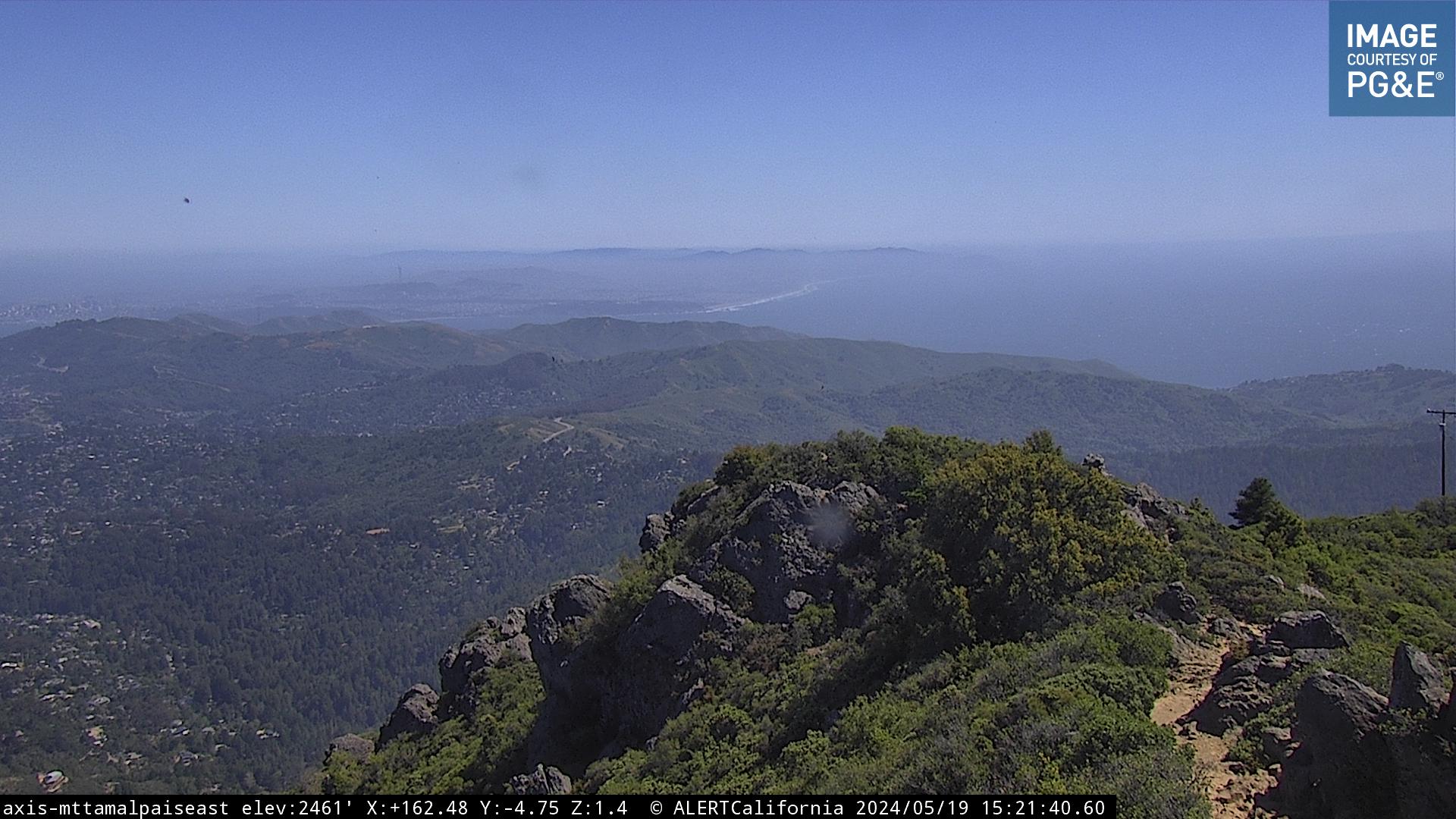
 Mt. Tam Fire Lookout
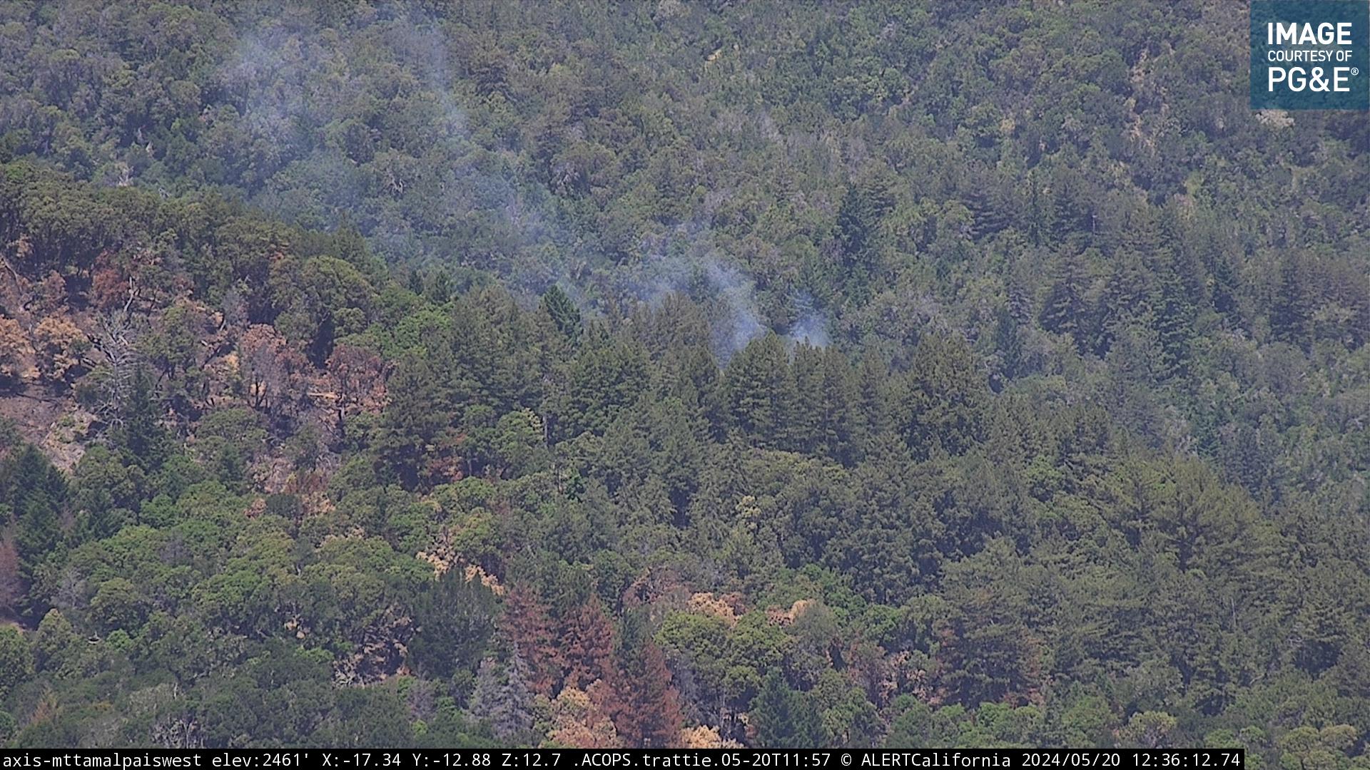
MCFD


 Mt. Tam Fire Lookout
MCFD

San Rafael – Big Rock Ridge Fire Cam
Muir Beach Cam
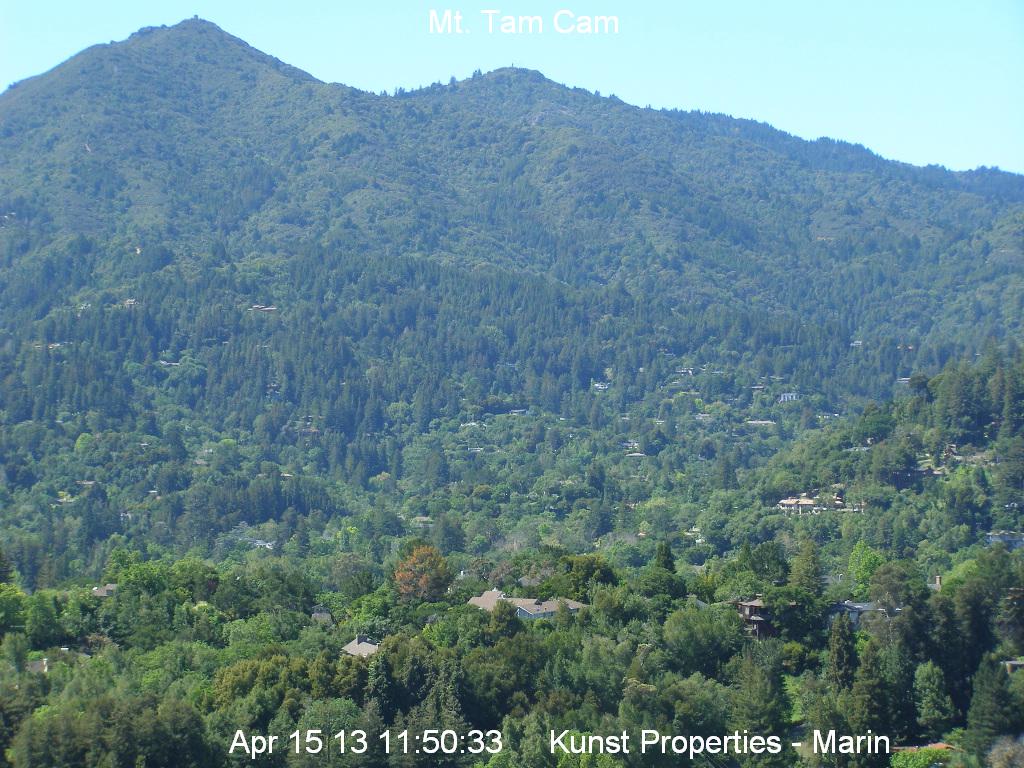
ABC 7 – Mt. Tam Cam from Middle Peak
St. Francis Yacht Club
SF Cam 1
Cams 2
Cams 3
 Pt. Reyes Lighthouse cam

<UC Berkeley Cam
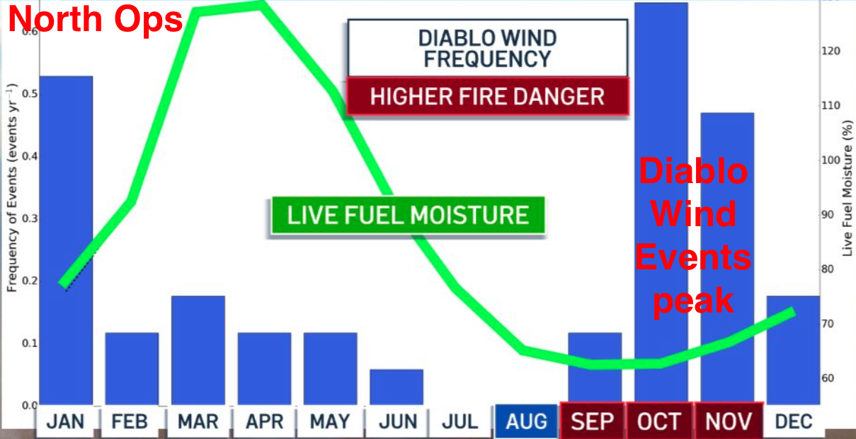
 Day 1 Fire WX Outlook
 Day 2 Fire WX Outlook

6 to 10 day temperature outlook

Rain forecast – 6 to 10 day outlook

Middle Peak Rain Gauge
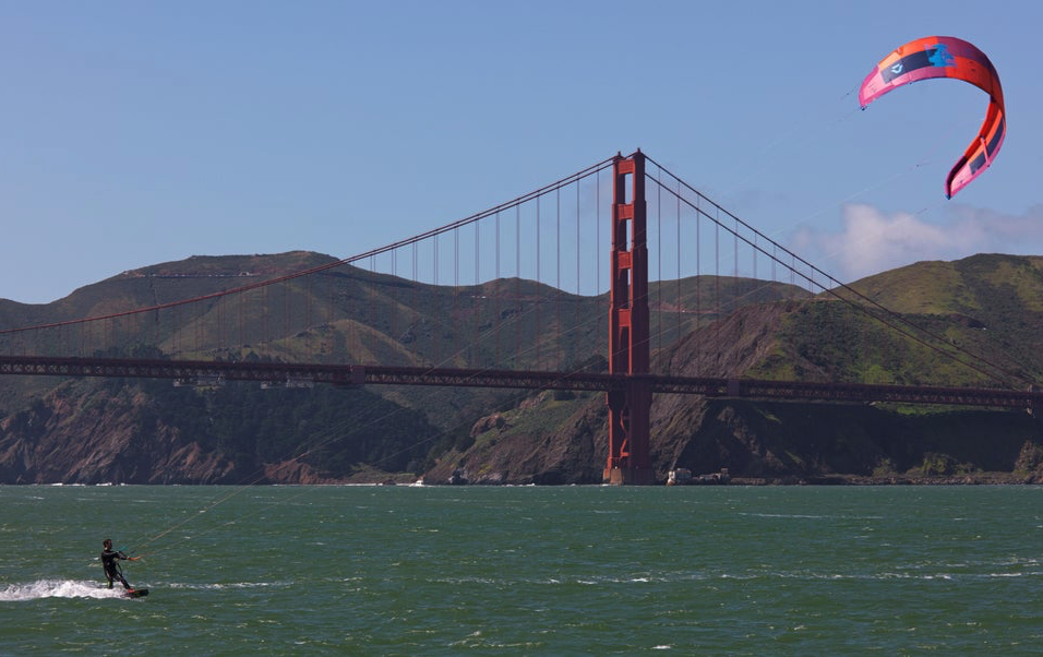
San Francisco windsurfing Cam live cameras

www.kimsnurturingnest.org
Kim nurturing nest animal rescue Danville
Mt Tam Summit weather station: 2,500 feet
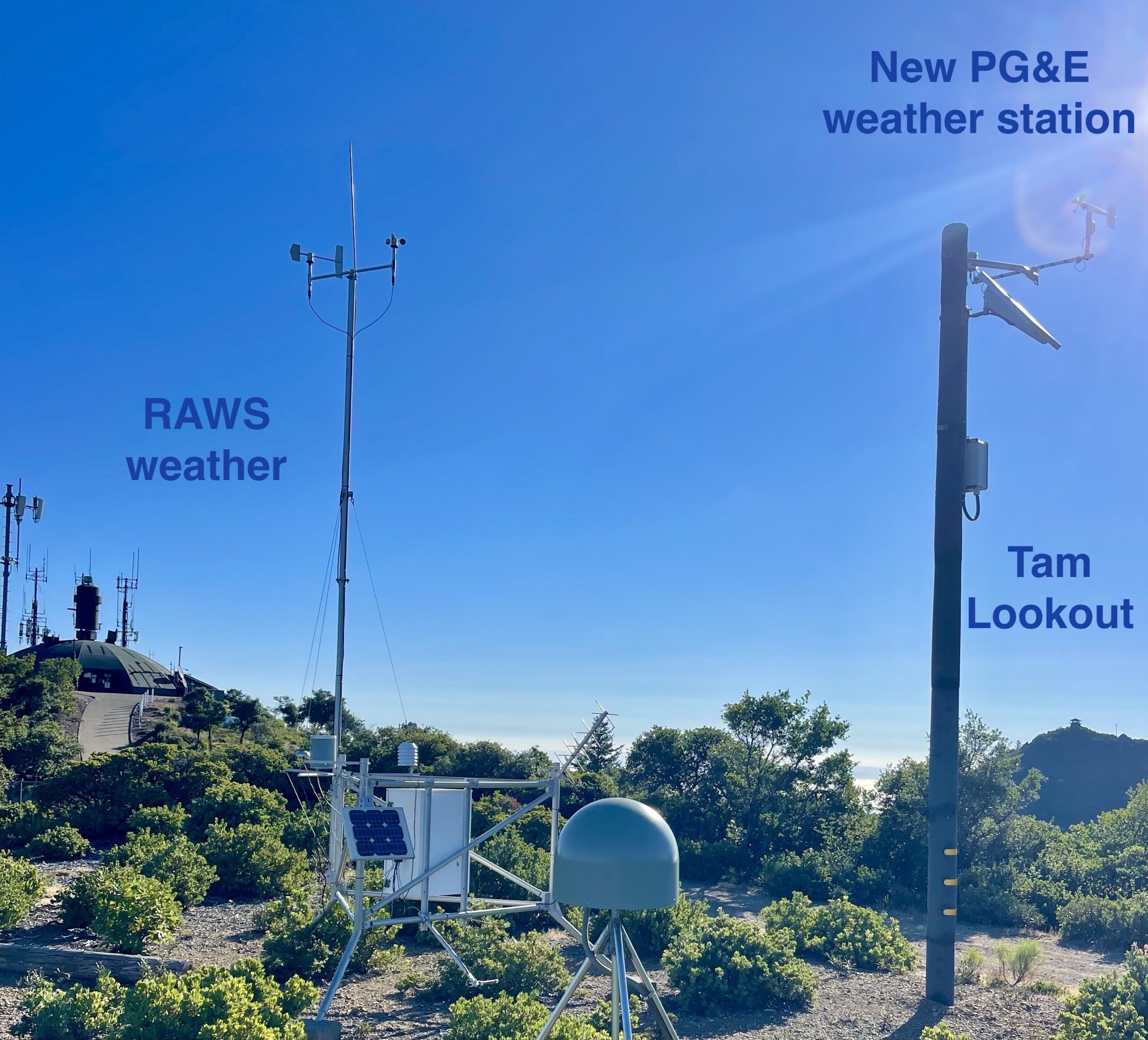
RAWS Station – reports every hour
Mt Tam Summit weather station: 2,500 feet
NEW PG&E weather station – reports every 10 minutes

PGE Middle Peak – 2,500 feet elevation
Fire Road Mill Valley – elevation 602′

Throckmorton Fire Station
(MCFD)
Drought Monitor

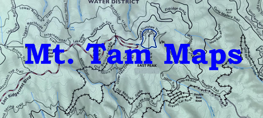
Trail maps and historic hiking map
Mt. Tam Drone Video
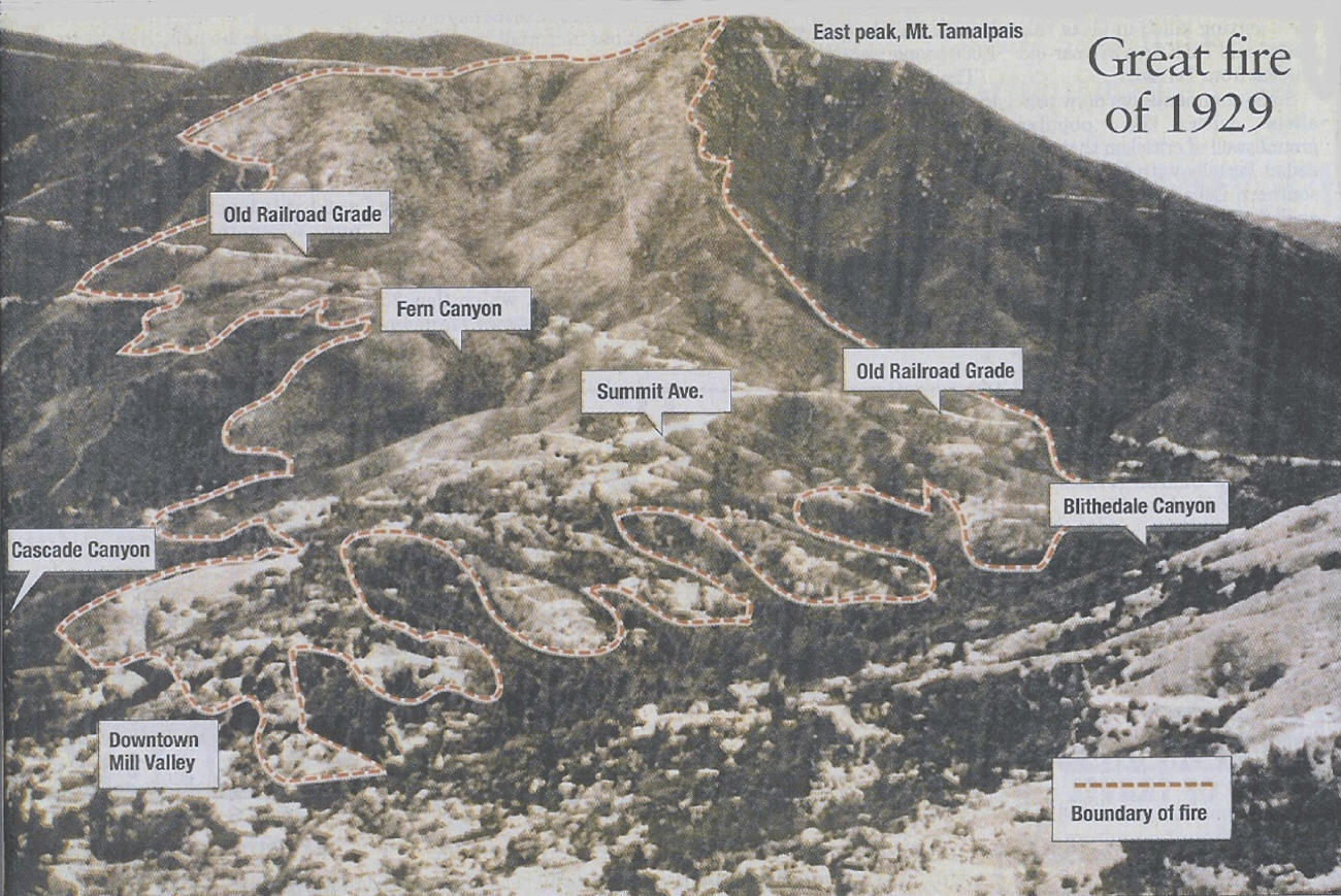
THE GREAT MT. TAMALPAIS FIRE OF 1929
The fourth largest Marin County fire, and the worst in terms of financial losses, was first reported on July 2, 1929 at 2:45 pm. It was an exceptionally hot, summer day with dry, 30 to 35 mile per hour winds blowing from the east. From his East Peak lookout, a veteran fire lookout spotted smoke at 2:00 p.m. coming from the area near the “Garden of Allah”, now the Ralston White Retreat Center, and the railroad grade near the Double Bow Knot in Mill Valley. Clinton Thoney, had been appointed Mill Valley fire chief on July 1st, quickly sounded the siren to alert all volunteers. The warm winds soon turned the fire into a “firestorm” and blew the flames down the mountain, devouring the tinder-dry feast of grass and shrubs covering Mount Tamalpais as it raced toward downtown Mill Valley. Bells and sirens sounded. Fire leapt from house to house, tree to tree. The wind carried embers up hillsides and across valleys. Moving fast toward Summit Avenue, it threatened to destroy everything in its path. Middle Ridge was evacuated. Fingers of fire burned down toward Throckmorton and Cascade Canyon. One motorist fleeing the fire down Summit Avenue lost control of his car, which crashed and burned, setting fire to five houses before it burned itself into the main fire. The engineer on the mountain railroad coming toward town had to keep the brakes on, as the tracks were made slippery by hundreds of snakes fleeing the flames. “The whole ridge was nothing but a red mass of fire. You’d be downtown and hear someone say, ‘There goes my house,’ and he’d just stand there like a statue, staring. When you see 50, 75 or more houses going up at once, it is quite a spectacle,” one eyewitness said. Firefighters arrived from all over the Bay Area, including the San Francisco crews who came on the ferry with their engines. (Tragically, they discovered that their hoses did not fit Mill Valley’s hydrants!) The town center resembled a refugee camp as volunteers worked to feed the firefighters and provide places for them to rest. By 9:30 p.m. the fire was within 100 yards of the fire station at City Hall. A sudden shift in the wind turned the fire back on itself, saving the downtown business district but not before between 110 and 117 homes had been destroyed. The fire that torched much of the southern slope of Mt. Tamalpais continued to burn out of control until July 5th, and was reported in newspapers throughout the United States. Estimates of the extent of the fire range from 1,000 to 2,500 acres, with most reports agreeing on 2,500 acres. The financial loss was estimated at $1,045,500, (Per Grok AI: Using the national housing index and Mill Valley’s market premium, the $1,045,500 loss from 1929, when adjusted for housing price inflation, is approximately $28,227,000 in 2025 dollars. This accounts for the national housing price trends and Mill Valley’s elevated market 4x national median = potentially $30M–$40M in losses). There is also more than double the number of homes in this area. The loss included destruction of most of the railroad tracks and the station on the mountain, as well as many valuable private art collections. To this day, scars from the fire can still be seen on the trees around the Ralston White Retreat. How the fire was started is still a mystery. Speculation is that a spark from the old railroad train, a cigarette thrown from the train or possibly very dry grass that had heated under discarded glass began the blaze. Mount Tamalpais Tavern, a popular tourist destination at the summit. On June 30, 1929—just days before the Mill Valley fire—a separate blaze consumed the Tavern, which had been built in 1898 as part of the Mount Tamalpais and Muir Woods Railway. This fire, reported as a spectacular event visible from San Francisco, reduced the 35-room hotel to ashes. Oddly enough the Mt. Tam Railroad was put back into service shortly after the fire, but closed permanently in 1930. Tracks were pulled up and sold. Engines were sold, mostly to logging companies. Two engines went to the Philippines. (Engine No. 9, the only piece that survives, is currently being restored) The fire was an important factor in the decision to shut the line down, but the real culprit was the automobile. It clearly signaled the end of an era.
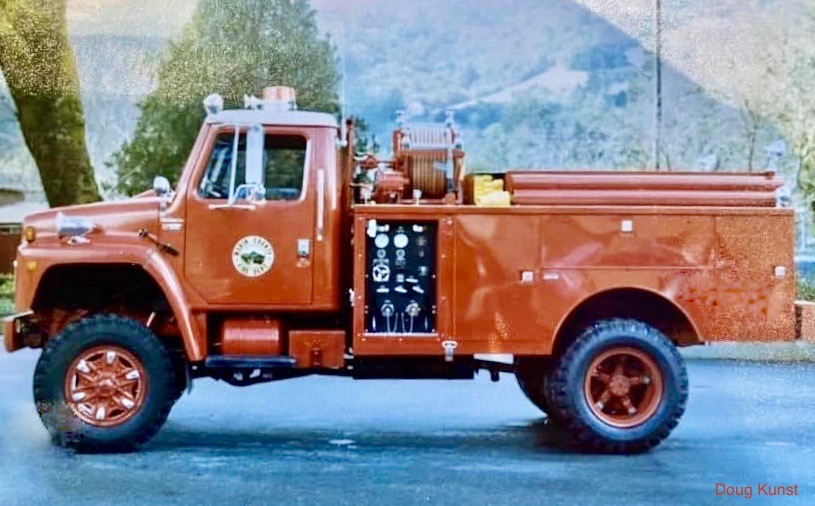
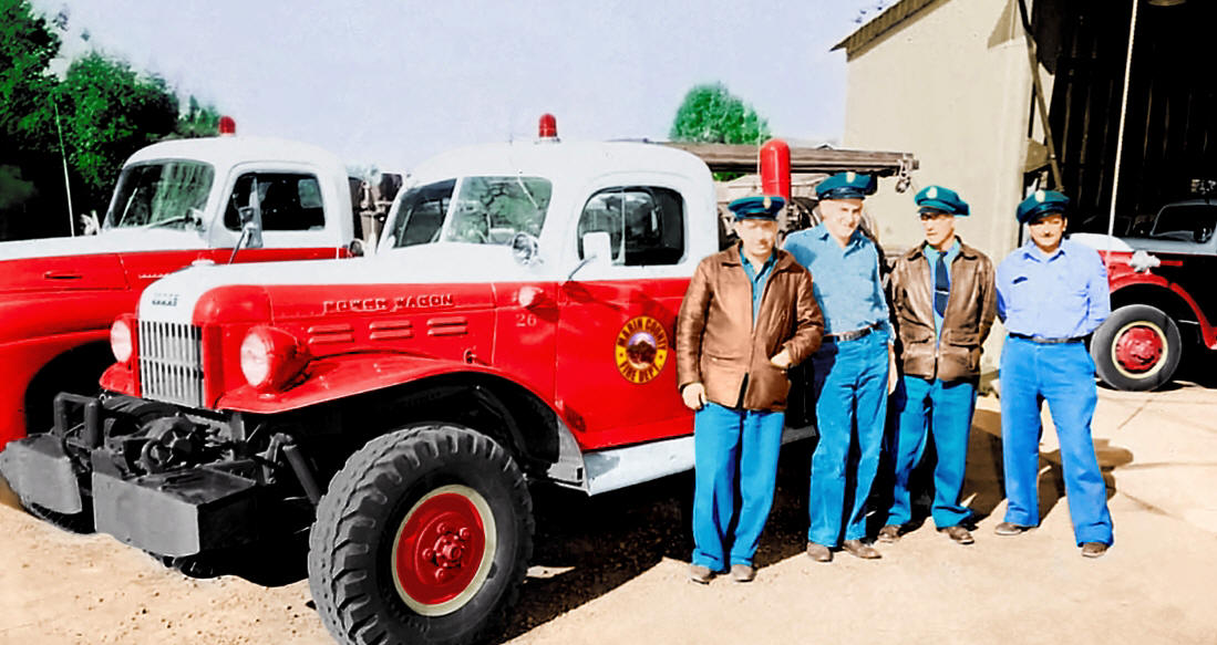
Marin County Fire – Dodge Power Wagon
San Francisco windsurfing Cam live cameras
Website by Doug Kunst (SRV Fire Capt. ret)
SRVFire@gmail.com
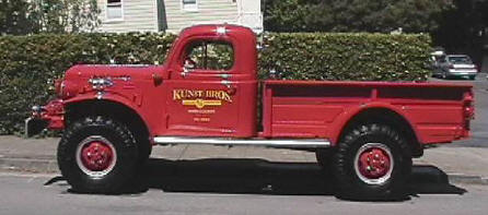
 Kunst Bros. Painting Marin
Best Price * BestService * Best Quality
For the past 20 years Consistently Best in Marin.
This year is no different Best of Marin 2024 Hall of Fame
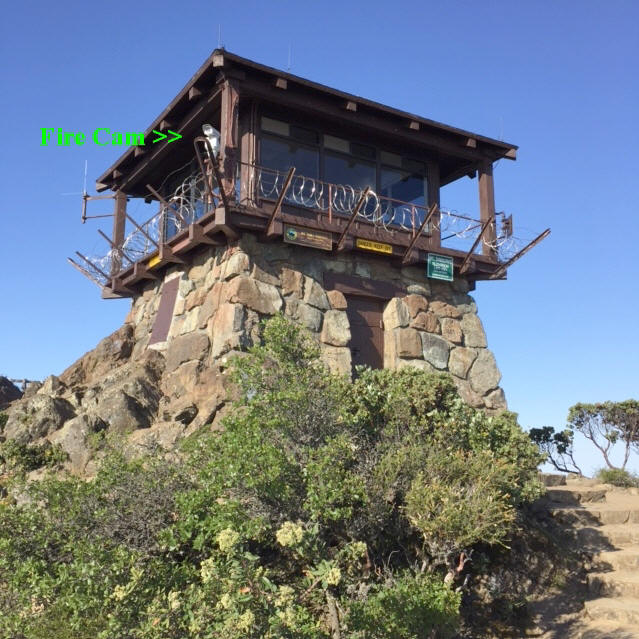
Mt. Tam Fire Lookout photos
Popular links:
Mt. Diablo Fire Cams srv San Ramon Valley Danville weather
Marin Fire Cams lookout cameras mountaintop
Southern Cal fire weather and fire cams
Tiburon Cam – Angel Island Webcam Belvedere camera
Mt. Tam Cam – Tamalpais webcam trails maps
Santa Cruz Cam – Monterey webcams
Lake Berryessa Fire Cams boating webcams
Lake Shasta Fire Cams houseboat cam weather
Santa Barbara County Fire webcams
Southern California San Diego County Fire Lookout Cams
Napa Valley Cam – Live Webcam st. Helena cams
San Francisco windsurfing cams
RECREATIONAL RESOURCES: Within the park, more than sixty
miles of trails meander through the Park’s landscape and connect with a
200 mile trail network through adjacent public lands. The 3500 seat
Cushing Memorial Theater, 2,000 feet above San Francisco Bay, has been the
site of the annual Mountain Play since 1913. For information, contact the
Mountain Play Association at (415) 383- 1100. Group camping is available
at Alice Eastwood Group Camp and the Frank Valley Horse Camp. Reservations
through Reserve America at (800) 444-7275. Adjacent to the Pantoll Ranger
Station are 16 individual walk-in campsites (available on a first come
first serve basis). The beautiful Steep Ravine area, located on a rocky
headland two miles south of Stinson Beach, offers primitive overnight
camping. There are six environmental campsites and ten rustic cabins.
Steep Ravine is a very popular campground and reservations are required
(Note that Steep Ravine is listed under Environmental Camping for Mt.
Tamalpais, when you call Reserve America).
HISTORY: Many people believe that the 2,571-foot peak is the remains of an
extinct volcano. Geologists have decided that Mt. Tamalpais was created by
the process of buckling and folding within the earth’s crust. The San
Andreas Fault lies offshore to the west, marking the division between two
large pieces of the Earth’s crust: the North American Plate and the
Pacific plate. The Pacific plate is moving eastward and down under the
North American plate, thus uplifting Mt. Tam and the Coast Range.
NATURAL RESOURCES: Home to several rock-types; sandstone(graywacke),
shale, greenstone, chert, quartz, tourmaline, and the green serpentine,
which is the state rock of California. Mt. Tam is also a host to a number
of plants; more than 750 species, including both the Coast Redwood and the
delicate Calypso Orchid, Oak, Chaparral, Douglas Fir and California Laurel
Tan Oak. Mt. Tam’s hillsides are sprinkled with California poppies, many
species of lupine, all shades of Douglas iris, blue-eyed grass,
goldfields, shooting stars, spotted coral root, fetid adder’s tongue,
Pacific trillium. Home to many animals; raccoons, gray foxes, squirrels,
bobcats, coyotes, mountain lions, and black-tailed deer. Red-tailed hawks,
turkey vultures, great horned, spotted, barn and screech owls,
woodpeckers, Steller’s jays and black ravens..
CULTURAL RESOURCES: The Mt. Tamalpais Scenic Railroad was completed in
1896 and ran from Mill Valley to the East Peak summit. A hotel,
restaurant, and dance hall followed shortly to make Mt. Tam a popular
destination around the turn of the century until 1930, when automobiles
became to favored mode of transportation. Called the “Crookedest
Railroad in the World”, the ride up the mountain was only surpassed by
the ride down the mountain in a Gravity Car. These 30-passenger cars had
only a brakeman to control the roller-coaster descent back to Mill Valley
or Muir Woods.
West Point Inn
Secluded amongst the trees on the upper south slope of Mt. Tamalpais, in
Marin County is the historic West Point Inn. Built in 1904 as a stopover
and restaurant on the Mill Valley/Mt. Tamalpais Railway line, this rustic
inn offers panoramic views of the East Bay, San Francisco, the Marin
Headlands, and one tower of the Golden Gate Bridge.
The Inn is now under the jurisdiction of the Marin Municipal Water
District but is operated by a non profit organization, the West Point Inn
Association. The Inn consists of 5 rustic cabins, a communal fully
equipped kitchen, a large living area with fireplace, a deck with
phenomenal views, a single use restroom on the deck with a roll-in shower,
and seven additional guestrooms upstairs in the main lodge.
To reach the Inn, the general public has to hike in, however, if you are
not able to hike in, you are allowed to drive in down the two-mile dirt
road. The cabin is basically a place to sleep and not spacious enough for
just hanging out.
There is no electricity and you will need to bring your own food, towels
and sheets/sleeping bag. On the weekend there is a throng of bicyclists
and hikers on the trail adjacent to the inn. Part of the Inn is open to
the public during the daytime so it ends up not being so private. During
the week it is much less crowded and the evenings are extremely peaceful.
General information: 415-388-9955
Crookedest Railroad
Construction of the “Crookedest Railroad in the World” began on February
5th, 1896. There is no clear account of when engineering and surveying
began, but undoubtedly that occurred some time before. The last spike was
driven on 18, August 1896. The first passenger train with Mill Valley
citizens aboard went up the mountain on 22, August 1896. The Grand Opening
took place 26 August primarily for the press.
The original railroad road bed was 8.25 miles long with 22 trestles and
281 curves. The longest straight stretch was in the middle of the Double
Bow Knot, a distance of 413 feet. The rails were 57 pound steel with
redwood ties. The cost of construction was reported to be $55,000, with
another $80,000 for equipment. Original equipment consisted of one Shay
engine of 20 tons, one Heisler engine of 30 tons, six open canopied cars,
one San Francisco cable car and two flat cars. Regular operations began 27
Aug. 1896. The grade averaged 5% while the steepest part, just down the
grade from the summit a short distance was a modest 7%.
The Gravity Grade to upper Muir Woods from Mesa Station was 2 1/2 miles
with a grade varying from 4% to 7%. One of the primary motivations for
building the Gravity Car Grade was the Muir Woods Inn proposed by Mr. Kent
(not yet Congressman Kent). Financing delays caused a change in plans and
the Inn was later constructed by the Railroad. Operation of this segment
officially began in 1907, but not on a regular basis. Shuttle service
began in 1908 not long after President Teddy Roosevelt accepted title to
Muir Woods for the Federal Government and it became a National Monument.
This provided the impetus for heavy use of the Gravity Cars during 1908.
Additional cars and engines were purchased at regular intervals and some
of the first equipment was sold later to find use in Northwest logging
operations. A 25 passenger railcar was purchased to aid in the shuttle
operations.
Initially the method of operating the trains was for the engine to pull
the cars. It later became clear that a safer way was for the engine to
push the cars up the mountain and when the cars came down with an engine,
the engine led . This had obvious safety advantages, and according to
accounts of the time it also provided better viewing ahead when the train
was ascending. This procedure and the other safety measures worked to a
remarkable degree for their were no passenger lives lost during the entire
period of the railroad operation. Two men associated with the railroad
were killed. One was scalded to death in an accident involving an
overturned engine. The other was killed in a head on collision between two
trains, but that was down in Mill Valley, not on the Mountain proper.
In 1911 plans were developed to extend the rail line from West Point Inn
down the Old Stage Coach Road to Willow Camp and thence on to Bolinas, the
last part by ferry. Bolinas was a fairly large community then, much larger
than Willow Camp, now called Stinson Beach. Much engineering was done
including publishing of schedules, but the line never went beyond a short
distance from West Point Inn and was used primarily as a siding to switch
cars.
A second gasoline powered motorcar was built in the Railroad Shops in Mill
Valley and put into service in 1912. The car had two speeds in either
direction and could reach 25 MPH on the return climb from Muir Woods. The
Gravity Car Grade passed through the Mine Ridge cut at Mountain Home and
there was a pipeline truss bridge suitable for hikers bridging the cut.
The Railroad was reorganized in 1913 as the Mt. Tamalpais and Muir Woods
Railway. The company had 6 locomotives including 5 Shays, 19 wooden open
cars, 16 Gravity cars plus 7 other cars and coaches. The Gravity Car time
schedule from the Tavern down was 8 minutes to West Point, 12 minutes to
Double Bow Knot and 14 minutes to Lee St. Station.
One of the many safety rules in effect for railroad operations was that
any Gravity Car pulled by a locomotive that is, downslope from the engine
could not be occupied. Detailed safety regulations as regards speed,
number of passenger occupied cars per engine, sand introduction to clean
the flues and many others were developed and must have been very effective
considering the safety record of the Railroad.
Water for the boilers, for cooling the wheels and for the tavern operation
was a major operating concern. All engines and Gravity Cars had a small
tank just for applying a small jet of water to cool the wheels. A tank car
was devised initially for the purpose of hauling water to the tavern from
the Fern Canyon water tank. Later, a pumping station was installed about
half way down the Fern Creek trail to pump water to the Tavern. This
station continues to pump water to East Peak today. A normal train trip up
the mountain would include filling the tanks at the yard, a stop at Mesa
Station for water and another stop at Fern Canyon.
The first disaster occurred in 1913. A major fire raged for 5 days.
Presidio troops were called out the first day and before the fire was
contained more than 7000 firefighters were engaged in the fight. One San
Francisco newspaper stated that Mill Valley was doomed. Amazingly, no
railroad equipment or buildings were lost although several engines and
cars were scorched. The railroad and its crews contributed significantly
to controlling the fire.
In 1915 the railroad carried an average of 700 passengers per day during
the summer and handsome profits were realized. The War in Europe had a
negative effect on operations in 1917 and 1918, but by 1920 things were
booming again. The Tavern burned down in 1923, but was soon rebuilt on a
less grandiose scale. The trains continued to run even when there was no
tavern. When the Tavern was rebuilt it was designed to serve both railroad
and auto passengers.
The railroad continued to operate, although less actively until the great
fire of 2 July 1929. That fire was a near disaster for some of the
equipment and the crews. Again the railroad was a critical factor in
fighting the fire. Crews on the mountain were in great jeopardy and some
equipment was lost. One engine was abandoned and all the woodwork was
burned, but the engine was eventually put back in service. Oddly enough
the railroad was put back into service shortly after the fire, but closed
permanently in 1930. Tracks were pulled up and sold. Engines were sold,
mostly to logging companies. Two engines went to the Philippines. The fire
was an important factor in the decision to shut the line down, but the
real culprit was the automobile. It clearly signaled the end of an era.
Gravity Cars
One story about the Double Bow Knot was that when Cliff Graves was
Conductor on the run from East Peak to Muir Woods, he was required to
throw a switch to send the train down to Muir Woods. He would ride the
last car down and get off, unobserved, just above the Double Bow Knot, cut
down through the brush a short distance, throw the switch and be waiting
for the train when it appeared around the corner. It always amazed the
passengers. Another story was about Volley Thoney, who was a long time
employee of the Railroad. He claims to have come down the Mountain on a
single Gravity Car from the top to downtown Mill Valley in 21 minutes.
That is a distance of 8.2 miles and was done late at night when no other
cars were on the road.
Construction of the fantastically accurate Gravity Car replica is a story
in itself. Jerry Coe of Berkeley, California built the replica and was
supported by California State Parks. Urging and incentive was provided by
Park Ranger Randy Hogue, now deceased. Consultation and advice was
received from many sources, not the least of which was the fertile mind
and memory of 90 year old Bill Provines, former gravity car man on the
railroad during its heyday.
Historical research for construction was long and extensive since neither
plans nor original parts could be located. Research involved investigating
many sources of railroad memorabilia at museums throughout the States of
California and Nevada, including the San Francisco Cable Car Museum. All
the metal parts were cast, forged or milled largely by the methods in use
at the turn of the century. The wood used was also carefully selected and
sawn to conform to processes in use at that time. The nearly completed
Gravity Car was transported to San Francisco where it was painstakingly
painted during the week before the 18 August 1996 Centennial Celebration.
It was taken to the top of Mt. Tam for the day on the 18th for the
celebration and will be placed there permanently in the near future.
Popular links:
Mt. Diablo Fire Cams srv San Ramon Valley Danville weather
Marin Fire Cams lookout cameras mountaintop
Southern Cal fire weather and fire cams
Tiburon Cam – Angel Island Webcam Belvedere camera
Mt. Tam Cam – Tamalpais webcam trails maps
Santa Cruz Cam – Monterey webcams
Lake Berryessa Fire Cams boating webcams
Lake Shasta Fire Cams houseboat cam weather
Santa Barbara County Fire webcams
Southern California San Diego County Fire Lookout Cams
Napa Valley Cam – Live Webcam st. Helena cams
San Francisco windsurfing cams
Lake Tahoe Cam ski cams road conditions webcams
Mt. Tam Cam Tamalpais Tamalpias webcam trails maps
Website by: Doug Kunst (SRV Fire Capt. ret)